
Assessing Australia’s Stored Water from Space
An exploration of the use of Earth observation and other tools that can support the measurement and monitoring of stored water in Australia.
A bite-sized lunchtime exploration of the use of Earth observation and other tools that can support the measurement and monitoring of stored water in Australia. Hosted by Prof Joseph Awange from Curtin University, this webinar discussed challenges and future directions including state of the art approaches such as the assimilation of multiple products and machine learning models. We will heard an update on Australia’s ‘weather service for water quality’, AquaWatch.
Presenters:
Joining Joseph were presenters:
Dr Kexiang Hu, Chengdu University, China
Adam McLeod, CSIRO, AquaWatch Project Manager
Dr Mehdi Khaki, University of Newcastle
Read presenter bios here.
Webinar recording:
Audience chat:
Click here to read the chat window from the webinar.
Feedback:
Feedback on this webinar can be submitted here.

Where to next for teaching and training in remote sensing and Earth observation?
We discuss the current state, challenges and likely future directions for the teaching of remote sensing knowledge, skills and professional capabilities in all forms of post secondary education in Australia.
We discuss the current state, challenges and likely future directions for the teaching of remote sensing knowledge, skills and professional capabilities in all forms of post secondary education in Australia.
This webinar explores the gap between industry requirements for Earth observation professionals and how universities and other institutions are preparing employable, work-ready graduates through degrees, short courses, and training programs.
Case studies of new approaches are explored.
Presenters:
Hosted by Professor Stuart Phinn from the University of Queensland who is joined by:
Assoc Prof Karen Joyce – James Cook University
Dr Amy Parker – CSIRO
Dr Caroline Poulsen – Bureau of Meteorology
Tim Neale – DataFarming
Dan Tindall – Department of Environment and Science (Qld)
Prof Iain Woodhouse - University of Edinburgh / EarthBlox
Webinar recording:
Audience chat:
Click here to read the chat window from the webinar.
Feedback:
Feedback on this webinar can be submitted here.
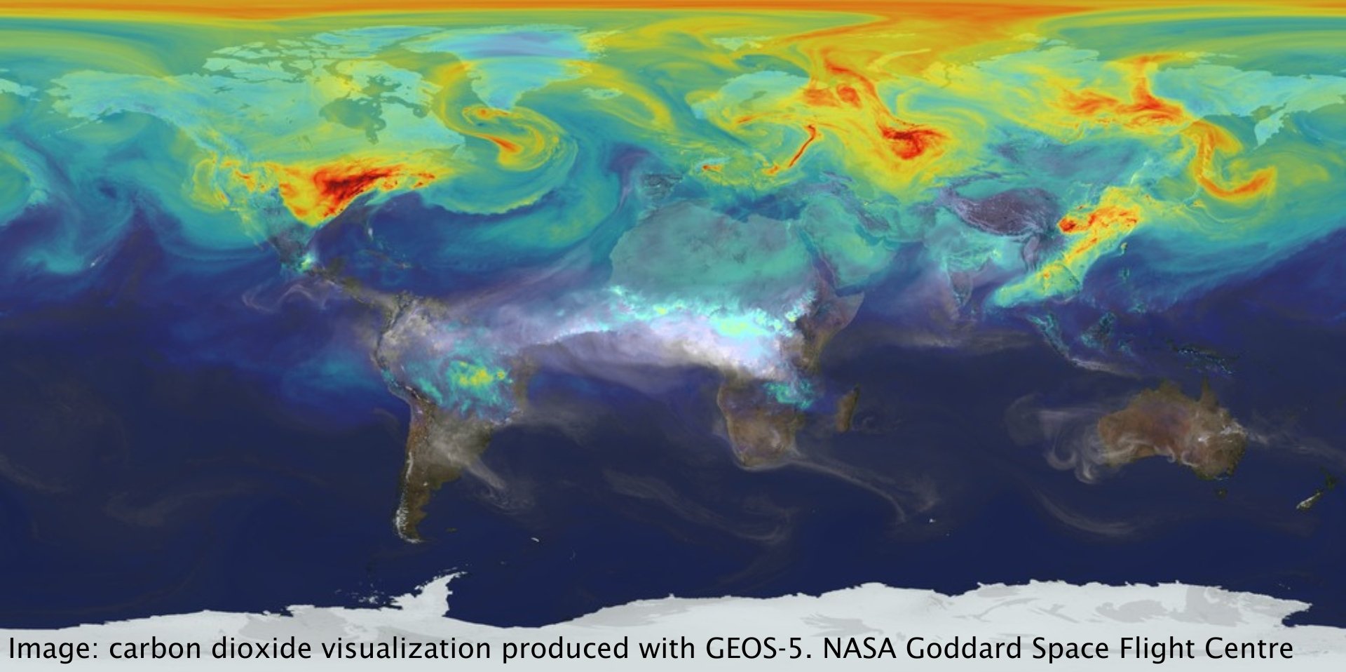
Using space-based Earth observations to understand and tackle the climate challenge
A webinar to provide the Australian Earth observation (EO) community with an overview of current and predicted future capabilities of EO to contribute high value climate data.
A webinar to provide the Australian Earth observation (EO) community with an overview of current and predicted future capabilities of EO to contribute high value climate data. This webinar was also the start of an EOA-lead ongoing conversation about Australia’s strengths and how we can best contribute globally to climate data supply, access and analysis.
Host, Caroline Poulsen from the Australian Bureau of Meteorology moderated a Q&A with our presenters
Presenters:
Dr Anthony Rea - World Meteorological Organization
Overview of the Global Climate Observing System and Essential Climate VariablesDr Rob Massom - Australian Antarctic Program
Antarctica’s Frozen Ocean - Sea Ice Change and VariabilityPeter Rayner - Superpower Institute / Honorary Professorial Fellow, University of Melbourne
Remote Sensing of Greenhouse Gases and its Role in Climate MitigationRakhesh Devadas, PhD - Australian Bureau of Agricultural and Resource Economics and Sciences
Mapping Australia’s Land Use
Webinar recording:
Audience Chat:
Click here to read the chat window from the webinar.
Growing Australia’s Earth observation workforce: finding, and hiring for, early career EO jobs
For employers and people looking to work in Earth observation (EO) alike, this webinar discussed: the demand for EO-skilled employees in government and industry; key EO knowledge and skills and which students are acquiring these at university; and how to bring graduates into EO from a range of backgrounds.
Both employers and people looking to work in Earth observation (EO) will be interested in this webinar where we discussed:
the demand for EO-skilled employees in government and industry;
key EO knowledge and skills and which students are acquiring these at university; and
how to bring graduates into EO from a range of backgrounds.
Our host for this 'in conversation with' style webinar was the current Earth Observation Australia Inc. (EOA) Ambassador, Dr Caitlin Adams who is the 2022 recipient of the EOA award for " Early-Career Contribution to the Development of the Australian Earth Observation Community and its Capabilities". Caitlin is Senior Data Scientist at FrontierSI.
Presenters:
Joining Caitlin to talk about the opportunities and challenges of building Australia's EO workforce were:
Dr Jasmine Muir - SmartSAT CRC and Symbios Communications
Norman Mueller - Geoscience Australia
Professor Stuart Phinn - University of Queensland
This was a highly interactive event where the chat window was widely used by the panel and participants. A link to a copy of the chat window can be found below.
Webinar recording:
Audience chat:
Click here to read the chat window from the webinar.

Using Earth observation to support decision making in Australia
This webinar showcased real world examples of how Earth observation (EO) derived insights have helped with organisational and individual decision making across different sectors in Australia.
This webinar showcased real world examples of how Earth observation (EO) derived insights have helped with organisational and individual decision making across different sectors in Australia. Our presenters shared insights on the challenges and opportunities of using EO to drive better decisions and change.
Hosted by Dr Fang Yuan from FrontierSI, this webinar included diverse case studies of decision making that are supported by EO derived insights as well as a discussion about the advantages and constraints of using EO data.
Presenters:
Dr Kristin Williams, Principal Research Scientist, Living Landscapes, CSIRO Land and Water
Campbell Mauchan, Vice President of Partnerships, AgriWebb
Bronwen Clark, Chief Executive, National Growth Areas Alliance
Webinar recording:
Audience chat:
Click here to read the chat window from the webinar.

NASA PACE Mission: exploring Australian data use and applications
Explore NASA’s Plankton, Aerosol, Cloud, ocean Ecosystem mission, as well as the Community of Practice and Early Adopters programs designed to support and assist the use of the PACE data products.
PACE is NASA's Plankton, Aerosol, Cloud, ocean Ecosystem mission, currently in the design phase of mission development. It is scheduled to launch in 2024.
PACE will advance the assessment of ocean health by measuring the distribution of phytoplankton, and continue systematic records of key atmospheric variables associated with air quality and Earth's climate.
This webinar explored the mission, as well as the Community of Practice and Early Adopters programs designed to support and assist the use of the PACE data products.
Presenters:
Erin Urquhart, PACE Applications Coordinator, Ocean Ecology Lab, NASA Goddard Space Flight Center
Lachlan McKinna, Director & Lead Oceanographer, Go2Q Pty Ltd
Webinar:

Airborne Earth observation - critical pillars in EO sciences and applications
Held as a part of the webinar series leading to the Advancing Earth Observation Forum 2022.
Given the current national focus on satellite-based Earth observation (EO), what future roles are there for airborne sensing?
Given the current national focus on satellite-based Earth observation (EO), what future roles are there for airborne sensing?
This webinar explored this question with leaders in airborne EO as well as demonstrate the extent of the airborne EO industry in Australia and identified direction for collaboration with space- and ground-based EO activities. Current and planned airborne activities across industry, government, not-for-profit and university sectors were showcased.
Hosted by EOA President, Prof Megan Lewis.
Presenters:
Daniel Kruimel - Sales Manager, AAM
Dr Paul Dare - Chief Executive Officer, FireFlight Technologies
Dr Andrew McGrath - Airborne Research Australia
Webinar recording:

SMEs and Government Partnering to Grow Australian Earth Observation Capabilities
Held as a part of the webinar series leading to the Advancing Earth Observation Forum 2022.
A discussion on how Australia’s Earth observation capabilities can be strengthened through the involvement of both government and SMEs.
During this webinar we discussed how Australia’s Earth observation capabilities can be strengthened through the involvement of both government and SMEs.
Taking examples from diverse sectors explored models for SME/government partnerships that not only meet the working and operational requirements of all parties, but also support best practice deliverables.
There is universal agreement that SMEs will be important in the growth and development of Australian Earth observation. This webinar provided a platform to start a wider conversation about the practical aspects of realising the potential within our start-up and SME community.
Hosted by EOA President Prof Megan Lewis.
Presenters:
Dr Brendon McAtee - Industry Engagement Manager, FrontierSI
Lieutenant Colonel Keiran Vidal - Geospatial Officer, Australian Army
Dr Naomi Mathers - General Manager, Geospatial Intelligence
Webinar recording:

Drone Earth Observation critical pillars in Earth observation sciences and applications
Held as a part of the webinar series leading to the Advancing Earth Observation Forum 2022.
This webinar demonstrated through industry, government, not-for profit and university drone programs, how drone based Earth observation continues to grow and enable quantitative environmental monitoring.
This webinar demonstrated through industry, government, not-for profit and university drone programs, how drone based Earth observation continues to grow and enable quantitative environmental monitoring.
We explored:
Drone activities in the national Terrestrial Ecosystem Research Network (TERN) focusing on standardised data collection and processing protocols to enable ecosystem monitoring.
Challenges and constraints to government use of drones for quantitative environmental monitoring.
Local scale soil and plant monitoring using drones to inform waterway flow management.
Hosted by Dr Renee Bartolo, Chief Remote Pilot, Department of Agriculture, Water and the Environment.
Presenters:
Jason Barnetson - Queensland Department of Environment and Science
Prof Arko Lucieer - Deputy Head of School, Geography, Planning, and Spatial Sciences, University of Tasmania
Dr Christine Lauchlan Arrowsmith - Principal Engineer, Streamology
Webinar Recording:

Engaging with Australia’s Analytics Data Hubs
Held as a part of the webinar series leading to the Advancing Earth Observation Forum 2022
A webinar to help you understand how you can engage with major government funded, State and national Earth observation data analytics hubs, nodes and services and what you will get from that interaction.
A webinar to help you understand how you can engage with major government funded, State and national Earth observation data analytics hubs, nodes and services and what you will get from that interaction. This webinar explored how these hubs can be a complementary and connected set of facilities that can work nationally to increase Australia’s EO capacities.
Our panelists are from the Australian Space Data Analysis Facility (ASDAF), CSIRO Earth Analytics Science and Innovation Platform, Digital Earth Australia, and Arlula. They will be discussing the future of analytics data hubs and the innovative ways you will be able to access and use Earth observation data in the future. Our panel members are ready to hear your thoughts and answer your questions.
Hosted by Prof Megan Lewis and Prof Stuart Phinn from Earth Observation Australia.
Presenters:
Prof Melanie Johnston-Hollit - Director, Curtin Institute for Computation and Australian Space Data Analysis Facility
Trent Kershaw - Director, Business Development, Digital Earth Australia, Geoscience Australia
Dr Rob Woodcock - Senior Principal Research Consultant, Minerals, CSIRO
Sebastian Chaoui - Co-founder/CEO, Arlula
Webinar recording:

Whole of Community Webinar: Satellite Imaging Radar in Australia
Satellite Imaging Radar in Australia: Data access, application development and use
This webinar shone a light on the leaders and innovators developing and using satellite imaging radar applications in Australia.
Satellite Imaging Radar in Australia: Data access, application development and use
This webinar shone a light on the leaders and innovators developing and using satellite imaging radar applications in Australia. Imaging radar technologies are often referred to as “SAR” (Synthetic Aperture Radar), along with specific applications for measuring changes in surface elevation, as Interferometric SAR (InSAR).
This webinar looked at how CSIRO is changing access to SAR data through the NovaSAR National Facility and included case studies of satellite imaging radar applications by industry, researchers and government.
Presenters:
Dr Amy Parker, CSIRO
Greg Madden, Geoimage
Prof Linlin Ge, University of NSW
Webinar recording:

Coral Reef Habitat Mapping - From the GBR to Reefs Globally
Hear how approaches to coral habitat mapping on the Great Barrier Reef formed the basis to global coral reef mapping.
Dr Chris Roelfsema from The University of Queensland discusses how approaches to coral habitat mapping on the Great Barrier Reef formed the basis to global coral reef mapping.
Chris' presentation is followed by a Q&A session hosted by Prof Stuart Phinn and joined by Dr Mitchell Lyons and Dr Emma Kennedy.

Presenters:
Dr Chris Roelfsema - Senior Research Fellow (Coastal and Marine), School of Earth and Environmental Sciences, University of Queensland.
Prof Stuart Phinn - Professor of Geography, School of Earth and Environmental Sciences, and Director, Remote Sensing Research Centre, University of Queensland
Dr Mitchell Lyons - Research Fellow, School of Earth and Environmental Sciences, University of Queensland
Dr Emma Kennedy - Research Fellow, School of Earth and Environmental Sciences, University of Queensland
Read more about our presenters>
Downloads:
Video Presentation:
Presenter Bios:
Dr Chris Roelfsema - Chris is Senior Research Fellow (Coastal and Marine), School of Earth and Environmental Sciences, University of Queensland. His research interests are monitoring ecosystem health of coral reefs and seagrass habitats, integrating field and remote sensing image datasets, calibrating and validating remotely sensed imagery in coastal environments, and developing cost-effective benthic habitat mapping approaches. A number of projects he has worked on are used as standard practice in a number of resource management agencies and research institutes around the world. Chris is currently the principal investigator on two major coral reef habitat mapping projects: 1) mapping geomorphic zonation, bottom type and predicted coral type habitat over the Great Barrier Reef; and 2) mapping all coral reefs globally and developing a monitoring system, in partnership with Paul G. Allen Philanthropies; Planet; the Arizona State University and the National Geographic Society.
Prof Stuart Phinn - Prof Stuart Phinn's research interests are in measuring and monitoring environmental changes using earth observation data and publishing/sharing ecosystem data. Stuart is the Chair of the Committee that produced the Australian Earth Observation Community Plan – 2026. He is also a professor of Geography at the University of Queensland where he teaches remote sensing and directs the Remote Sensing Research Centre. The majority of his work uses images collected from satellite and aircraft, in combination with field measurements, to map and monitor the Earth's environments and how they are changing over time.
Dr Mitchell Lyons - is a postdoc in the Remote Sensing Research Centre, University of Queensland. His research can be described as a mixture of Ecology, Geography and Statistics. Mitchell finished his PhD in 2013, at the University of Queensland, which focused on developing new remote sensing methods for long term monitoring and change detection in terrestrial and marine ecosystems. Mitchell then moved to UNSW and shifted focus to the application of modern statistical and modelling approaches for large scale vegetation classification and mapping problems, with a side interest in drone-acquired image data. He also teaches some remote sensing, as well as programming and statistics. Mitchell's current focus is working on the Allen Coral Atlas global coral reef mapping project, where his primary activities include developing object-based (cloud-based, on the Google Earth Engine) classification and mapping algorithms and accuracy assessment.
Dr Emma Kennedy - Emma is a postdoc at the Remote Sensing Research Centre, University of Queensland, where she currently works full-time on the Allen Coral Atlas reef mapping project as a spatial ecologist. Her diverse research portfolio has included several high-profile collaborative projects, including a Resilient Reefs program that developed a range of novel monitoring, mapping and modelling tools to explore resilience on Australia’s Great Barrier Reef, and a global conservation planning initiative 50 Reefs that identified a long-term data-driven strategy for reef conservation. More recently, Emma was the scientific lead on the Catlin Seaview Survey, a coral reef monitoring program that used underwater-scooter technology and artificial intelligence to scale underwater monitoring capabilities. Emma is a passionate science educator and writes for BBC Wildlife Magazine, and was highlighted as an emerging leader in last years #AusScienceHeroes campaign.

Satellite data: a critical element of modern weather forecasting
Hosted by Agnes Lane, Australian Bureau of Meteorology.
Gain an insight into Australian Bureau of Meteorology satellite products and hear BoM scientists discuss analysis and forecasting using new generation EO from space, as well as satellite observations for space weather forecasting.
Gain an insight into Australian Bureau of Meteorology satellite products and hear BoM scientists discuss analysis and forecasting using new generation EO from space, as well as satellite observations for space weather forecasting.
Presenters:
Hosted by Agnes Lane, Australian Bureau of Meteorology.
Dr Christopher Griffin - Scientific Programmer, Weather and Environmental Prediction Group, Australian Bureau of Meteorology
An overview of BoM satellite products
Prof John Le Marshall - Senior Principal Research Scientist, Science and Innovation, Australian Bureau of Meteorology
Improving Analysis and Forecasting Using New Generation Earth Observations from Space
Dr Zahra Bouya - Space Weather Scientist, Australian Bureau of Meteorology
Satellite Observations for Space Weather Forecasting.
Downloads:
Video Presentation:

Accessing and Using the Copernicus Australasia Data Hub
Hosted by Earth Observation Australia in partnership with FrontierSI and on behalf of Geoscience Australia
The Copernicus Australasia Regional Data Hub is an amazing resource for anyone needing Sentinel satellite data for Australasia, the South Pacific or Australia’s Antarctic Territory. Its open, fast, trusted and reliable satellite data can be accessed without cost.
This webinar explains the multiple ways to access and download data from the hub, including:
Sentinel Australasia Regional Access (SARA) map-based GUISARA python API for advanced users;
NCI’s THREDDS server;
directly through the NCI’s file system for registered NCI users.
Hosted by Earth Observation Australia in partnership with FrontierSI and on behalf of Geoscience Australia

The Copernicus Australasia Regional Data Hub is an amazing resource for anyone needing Sentinel satellite data for Australasia, the South Pacific or Australia’s Antarctic Territory. Its open, fast, trusted and reliable satellite data can be accessed without cost.
This webinar explains the multiple ways to access and download data from the hub, including:
Sentinel Australasia Regional Access (SARA) map-based GUISARA python API for advanced users;
NCI’s THREDDS server;
directly through the NCI’s file system for registered NCI users.
Presenters:
Jessica Keysers, Frontier SI
Caitlin Adams, Frontier SI
Alla Metlenko, Geoscience Australia
Mike Peters, Geoscience Australia